By Lucretia Collins
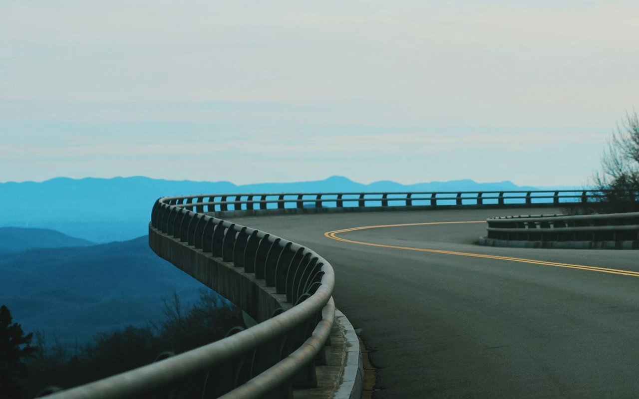
Some of the finest scenery in North Georgia reveals itself through the windshield, along winding mountain roads that climb, curve, and open onto sweeping Blue Ridge vistas. Blairsville sits at the heart of some of the best driving country in the state, with routes ranging from a leisurely half-day loop to a challenging climb toward Georgia's highest peak. Autumn turns these roads into corridors of red and gold, though the views reward a drive in any season.
This guide covers the best scenic drives near Blairsville GA, from national byways to local favorites.
Key Takeaways
- Russell Highway: A 16-mile route with three mountain overlooks.
- Scenic Byway: A 40-mile national byway loop through the mountains.
- Brasstown Bald: The drive to Georgia's highest peak rewards with four-state views.
- Vogel Route: A winding road past a state park toward Suches.
The Richard B. Russell Scenic Highway
Among the most celebrated scenic drives near Blairsville GA is the Richard B. Russell Scenic Highway, known locally as GA-348. This sixteen-mile route offers a leisurely mountain drive with several rewarding stops along the way.
- Three Overlooks: The route features three overlooks, including Hogpen Gap.
- Long-Range Views: Hogpen Gap offers picture-perfect views across the mountains.
- Fall Foliage: The route is a favorite for viewing autumn color.
- Appalachian Trail: The highway crosses the famous Appalachian Trail along its path.
The road is a particular favorite during the fall foliage season.
The Russell-Brasstown Scenic Byway
For a longer outing, the Russell-Brasstown Scenic Byway ranks among the finest scenic drives near Blairsville GA. This roughly forty-mile national byway loop winds through the Chattahoochee National Forest, connecting Blairsville with Helen and the surrounding mountain towns.
- National Byway: The roughly 40-mile loop is a designated national scenic byway.
- Waterfalls: The route offers access to waterfalls like those near Raven Cliffs.
- Mountain Vistas: Sweeping views of the southern Blue Ridge unfold along the way.
- Helen Connection: The byway drops into the Bavarian-style town of Helen.
The full loop makes for a genuinely memorable half-day or full-day trip.
Driving the Byway: Directions and Stops Worth Making
If you are starting in town, the byway is easy to pick up. The Fannin County Chamber’s scenic drives guide sends you south from Blairsville on Highway 129/19, left onto Highway 180, and then onto Highway 348, the Richard B. Russell Scenic Highway, about a mile later. Explore Georgia puts the full Russell-Brasstown loop at 40.6 miles.
Helton Creek Falls
A walk of less than a mile to a double waterfall in a mossy valley, one of the easiest waterfall stops near the byway.
Dukes Creek Falls
A scenic stop on the byway with a hike of about two miles.
Raven Cliff Falls
A five-mile round-trip hike to a dramatic, misty waterfall, best saved for a full-day outing.
Sources: Fannin County Chamber of Commerce & Tourism Office, “Mountain Discovery” scenic drives (accessed November 2026); Explore Georgia (Georgia Department of Economic Development), “Fall North Georgia Road Trip: Helen to Dahlonega”. Trail conditions change, so check with the Chattahoochee-Oconee National Forest before you hike.
Make it a two-stop day
Pair the byway with Helton Creek Falls for an easy morning, or save Raven Cliff Falls for a day when you have time for the longer hike. Either way, start early in peak leaf season, when the overlooks fill up.
For more ways to spend a day outside, see my guides to a day outdoors in Blairsville and hiking, fishing and farm life here. If this is the kind of weekend you want every weekend, take a look at Blairsville homes for sale.
The Drive to Brasstown Bald
No list of scenic drives near Blairsville GA would be complete without the climb toward Brasstown Bald, Georgia's highest point at 4,784 feet. The route follows GA-180 to the Jacks Gap entrance, then climbs a steep, winding road toward the summit parking area.
- Highest Point: Brasstown Bald is Georgia's highest peak at 4,784 feet.
- Four-State Views: The summit offers views of four states on a clear day.
- Winding Ascent: A steep, paved road climbs toward the upper parking area.
- Seasonal Beauty: Rhododendron in late spring and fall color both dazzle.
This drive rewards visitors with the finest views in the state. I love pointing clients toward this route for a truly memorable outing.
Brasstown Bald Visitor Details for This Season
You can drive most of the way, but not all the way. The Brasstown Bald Visitor Center explains that the road ends at a parking area below the summit, and you reach the observation deck by shuttle or on foot. Here is what to know before you go. If you would like help planning the trip, reach out to me.
$10
Per adult 16 and up during regular hours, shuttle included
$6
Per adult 16 and up after hours; free for 15 and under
10 a.m. to 5 p.m.
Staffed hours in season; last shuttle up at 4:30 p.m.
0.6 mile
The steep, paved Summit Trail from the parking area
Source: FIND Outdoors, operator of the Brasstown Bald Visitor Center in partnership with the U.S. Forest Service (accessed November 2026). Fees and hours were current at the time of writing.
Check conditions in late fall and winter
Public access is available year-round, but visitor services and the shuttle are seasonal, and fog, ice or snow can affect the road and the shuttle. The visitor center closes the Wednesday before Thanksgiving, Thanksgiving Day, Christmas Eve and Christmas Day.
On a clear day, the U.S. Forest Service says the observation deck takes in four states: Georgia, Tennessee, North Carolina and South Carolina.
Source: U.S. Forest Service, Brasstown Bald Visitor Information Center.
The Vogel and Suches Route
For a quieter drive, the route along GA-180 past Vogel State Park toward Suches ranks among the local scenic drives near Blairsville GA worth savoring.
- Vogel State Park: The road passes one of Georgia's oldest state parks.
- Lake Trahlyta: The route winds along the park's scenic lake.
- Hairpin Switchback: A dramatic hairpin turn adds character to the drive.
- Blood Mountain Nearby: The route connects toward the Blood Mountain area.
This narrow, smoothly paved road winds along Lake Trahlyta before climbing higher with each turn. I often suggest it to clients seeking a quieter drive through beautiful country.
Scenic Drives Between Blairsville and Nearby Towns
Some of the prettiest drives near Blairsville are simply the long way to the next town. Here are the town-to-town drives worth knowing, with the roads to take. For a favorite back road or two, just ask me.
Destination | The scenic way | Good to know |
|---|
Blue Ridge | Old Highway 76, a two-lane country road over Lake Blue Ridge Dam and through rolling farmland | About 21.2 miles; take four-lane Highway 515 back for a faster return |
Dahlonega | Wolf Pen Gap Road (Highway 180) past Vogel State Park to Suches, then Highway 60 to U.S. 19 | The long way through Suches, with overlooks and short hikes along the way |
Ellijay | Highway 515, the Georgia Mountain Parkway, through Blue Ridge and south to Ellijay | The easiest route; save the back roads for the way home |
Helen | The Russell-Brasstown Scenic Byway via Highway 348 and Highway 75 Alternate | Pairs well with Dukes Creek and Raven Cliff falls |
Turner’s Corner | Highway 129 south from Blairsville | A twisting ride with side trips to Vogel State Park, Mountain Crossings and DeSoto Falls |
Hiawassee | Highway 515, the Georgia Mountain Parkway, east toward Hiawassee | The same parkway that links Blairsville and Blue Ridge |
Sources: Fannin County Chamber of Commerce & Tourism Office, “Mountain Discovery” scenic drives (accessed November 2026); Explore Georgia (Georgia Department of Economic Development), “Fall North Georgia Road Trip: Helen to Dahlonega”. Road conditions and closures change; check before you go.
Wolf Pen Gap Road
A 12-mile, two-lane stretch of Highway 180 that passes Lake Winfield Scott and its gap at 3,260 feet. Curvy, quiet and gorgeous in fall.
Mountain Crossings at Walasi-Yi
An outfitter on the Appalachian Trail that helps more than 2,000 thru-hikers a year, with an interpretive center on the trail’s history.
Nantahala Gorge from Murphy
From Murphy, North Carolina, Highway 19/74 runs along an 8.5-mile stretch of the Nantahala River gorge with picnic tables and viewpoints.
Cherohala Skyway
A 40-mile skyway between Tellico Plains, Tennessee, and Robbinsville, North Carolina; plan on 1.5 to 2 hours just for the skyway.
Sources: Explore Georgia (Georgia Department of Economic Development), “Fall North Georgia Road Trip: Helen to Dahlonega”; Fannin County Chamber of Commerce & Tourism Office, “Mountain Discovery” scenic drives (accessed November 2026).
Thinking about a base closer to one of these towns? Read Mineral Bluff or Blue Ridge, owning a cabin in Suches and weekend to full-time living in Ellijay.
FAQs
What is the most famous scenic drive near Blairsville?
The Russell-Brasstown Scenic Byway, a roughly 40-mile national byway loop, is among the most celebrated, especially for fall foliage. The Richard B. Russell Scenic Highway that forms part of it is also a standout on its own.
Can I drive to the top of Brasstown Bald?
A paved road leads from GA-180 at Jacks Gap up to a parking area just below the summit. From there, a short walk or shuttle reaches the very top and its four-state views.
When is the best time for scenic drives near Blairsville?
Peak fall foliage typically arrives from mid-October through mid-November, making autumn especially spectacular. That said, these routes reward a drive in every season, from spring rhododendron to summer greenery.
Plan Your Next Scenic Drive Near Blairsville
How much time you have usually decides the route. Use this planner to match the drive to your day, and reach out to me, Lucretia Collins, if you would like to live with these roads right outside your door. You can browse Blairsville homes for sale any time.
Time you have | Try this | Why |
|---|
An hour or two | Highway 129 south toward Turner’s Corner and back, with a stop at Vogel State Park | Close to town with plenty of curves |
Half a day | The Richard B. Russell Scenic Highway with a short walk to Helton Creek Falls | Overlooks plus an easy waterfall |
A full day | The full Russell-Brasstown loop with Brasstown Bald, or the long way to Dahlonega through Suches | Georgia’s highest point or a town at the end |
A weekend | The Cherohala Skyway, or part of the 360-mile Southern Highroads Trail | The Fannin County Chamber says the full trail takes about three days |
Sources: Fannin County Chamber of Commerce & Tourism Office, “Mountain Discovery” scenic drives (accessed November 2026); Explore Georgia (Georgia Department of Economic Development), “Fall North Georgia Road Trip: Helen to Dahlonega”.
Live Close to Your Favorite Drive
Young Harris and Hiawassee
Blue Ridge and Mineral Bluff
Before You Head Out
- ✓Check weather and road conditions, especially for higher roads like Brasstown Bald in late fall and winter.
- ✓Fill up before you leave town; long stretches of these routes are national forest.
- ✓Download offline maps in case you lose signal in the mountains.
- ✓Start early on peak leaf weekends, when overlooks and trailhead lots fill up.
- ✓Pack water, a layer and good shoes if you plan to stop for a waterfall hike.
- ✓Thinking about a move? Start with a home valuation or browse my featured properties.
Explore More With Lucretia Collins
More Scenic Drive Questions
What is the scenic way from Blairsville to Blue Ridge?
Take Old Highway 76, a two-lane country road over Lake Blue Ridge Dam and through rolling farmland, about 21.2 miles according to the Fannin County Chamber. For a faster trip, four-lane Highway 515 connects the two towns.
What is the most scenic drive from Blairsville to Dahlonega?
Take Wolf Pen Gap Road (Highway 180) past Vogel State Park and Lake Winfield Scott to Suches, then Highway 60 to U.S. 19 into Dahlonega. Explore Georgia calls it taking the long way through Suches.
How do you drive from Ellijay to Blairsville?
Follow Highway 515, the Georgia Mountain Parkway, north through Blue Ridge to Blairsville. For a slower return, swap the Blue Ridge to Blairsville stretch for Old Highway 76.
How much does it cost to visit Brasstown Bald?
At the time of writing, FIND Outdoors lists $10 per adult 16 and up during regular hours, shuttle included, $6 after hours, and free admission for kids 15 and under. If you would love to live near Georgia’s highest peak, browse
Blairsville homes for sale or
reach out to me.
Is Brasstown Bald open in winter?
Public access is available year-round, but visitor services and the shuttle are seasonal, and ice, snow or fog can affect access. The visitor center closes the Wednesday before Thanksgiving, Thanksgiving Day, Christmas Eve and Christmas Day.
How long is the Russell-Brasstown Scenic Byway?
Explore Georgia lists the loop at 40.6 miles. From Blairsville, pick it up by taking Highway 129/19 south, turning left on Highway 180, and following Highway 348.
What is a good short scenic drive near Blairsville?
Highway 129 south toward Turner’s Corner is a twisting ride with easy side trips to Vogel State Park, Mountain Crossings and DeSoto Falls.
Want These Roads Right Outside Your Door?
Contact Lucretia Collins Today
The wealth of scenic drives near Blairsville GA is one of the genuine pleasures of mountain living, from the sweeping views atop Brasstown Bald to the winding byways that dazzle each autumn. These routes capture the natural beauty that makes this corner of North Georgia such a special place to call home.
I'd be honored to help you find a home with the mountains right outside your door. If this mountain lifestyle appeals to you, reach out to me,
Lucretia Collins.